Yorkshire3peaks
It was an early alarm as we had a table in The Station Inn at Ribblehead booked at seven that evening. We parked there overnight, there's no charge for vans if your using the pub.
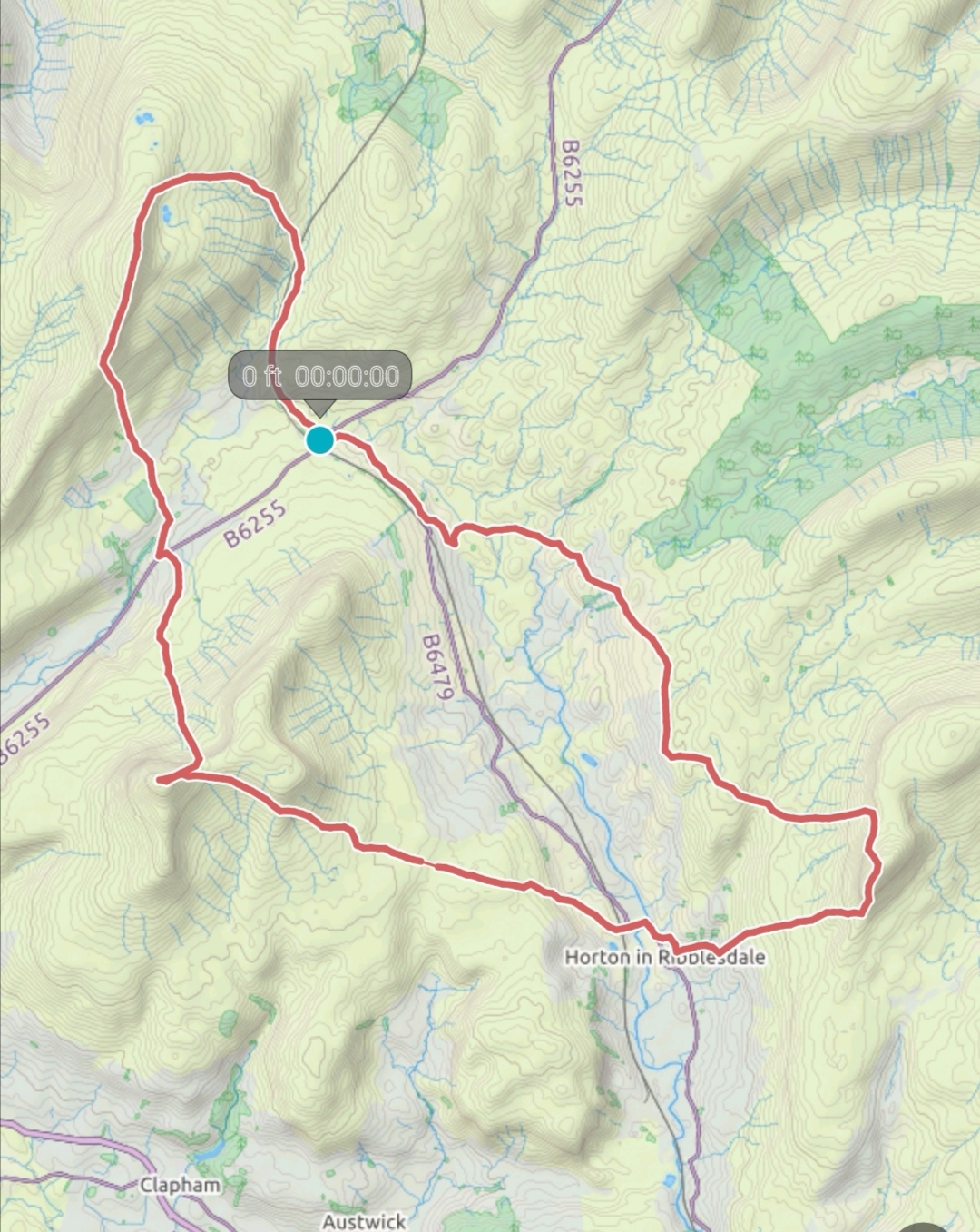
From there first on our route was Whernside, about two and half miles from the viaduct, the path follows the railway line crossing over it as it starts to rise. Passing a waterfall on your left side the incline increases.
Reaching the top you carry on past the summit cairn the path takes you back down and towards a farm, alot of work has been done to improve the path.
The farm runs a campsite and small cafe doing drinks, snacks and a toilet, pint of orange juice with ice goes down well. Carrying on through towards the main road turn left and past another campsite attached to a pub this time. The footpath is signed just after these.
The terrain is a little different on this side of the road. Limestone makes up most of the Dales formed millions of years ago from shells and sea creatures. Large pavements of limestone rock have been exposed during the last ice age the melt water forming cracks and pot holes visible all around the area. Continuing towards Ingleborough passing through a boggy stretch where large slabs have been laid the path up the side of the fell becomes apperent. Where we took a gradual path up Whernside we go straight up Inglebrough, the side of the fell forming the rough steps to the ridge along the top.
The top of Ingleborough is typical of the dales fells, large caps of millstone grit on top of the huge plateaus of limestone forming the distinctive flat top profiles. A summit cairn and a shelter are at the far side from there we retrace or steps back to the path that brought us up till it splits, we take the right hand path and down towards Horton-in-Ribbledale.
It's a good walk down into the village, about 6 miles, the path is clearly marked with sign posts and cross points. Entering Horton through the railway station head down towards the centre where there's a couple of pubs turning right towards the pay and display car park which also has toilets.
Carry on along the road taking the second footpath on the right. Head past the school building and up towards a farm where the footpath goes left and up onto the fells.
The veiws rewarding the climb come quickly with Whernside and Ingleborough being visible. Continuing up the fell following the stone wall on your left hand side, till you reach the Penine Way where you turn left towards the summit.
The climb now really starts, your path may not be obvious but unfolds as you follow it up the crag, some scrambling may be required but if you managed the stiles so far you'll not be troubled by the crag. It's a short walk to the trig point where there's also a shelter built into the wall.
We head on over and away from the stile on the other side of the walland down the side of the fell. We'd made good time for us till this point, it's around seven Mill back to the Station Inn and if we'd been able to maintain our pace we'd been more than pleased with a ten hour time. But the pace fell a little and the walk back ended up taking us nearly thee, so the total time ended up over 11. Still the quickest we've done it by around 20 minutes.
The path back crosses other paths and turns over stiles and through farms but remains well signposted and heads generally in the direction of Ribblehead.
The pub was a very welcome sight by the time we got there, the dog wasn't interested in coming to the pub and had his tea in the van followed by a long sleep.
The food, beer and hospitality is great and I can't recommend it enough and a very good night sleep followed, not disturbed by an impromptu late night get together formed by the other campers in the marque we only found out about in the morning.


Comments
Post a Comment